The project goal is to derive a recommendation for a tree species composition which is adapted to the changing climate and local conditions in Germany.

1. Analysis of high resolution aerial digital ortho photos (DOPs)
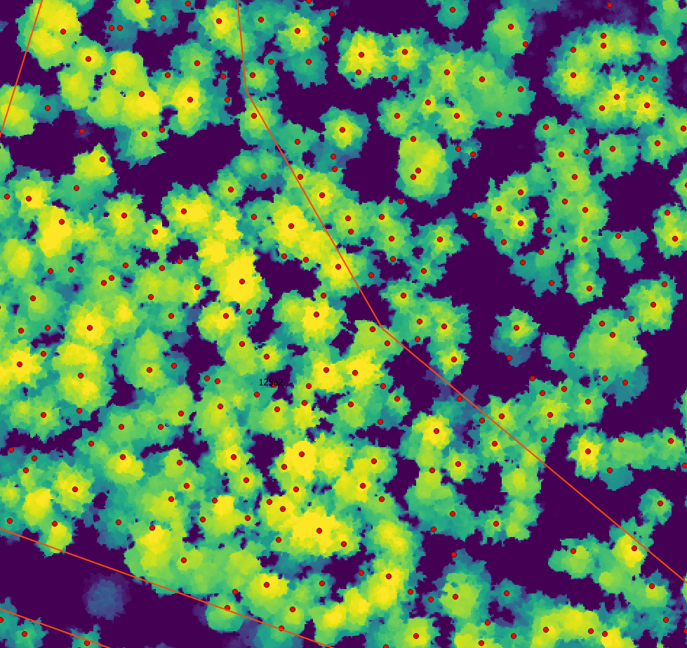
- a) Development of a deep learning based method for single tree detection and crown delineation
- b) Development of a method for estimating local species composition
- c) Application of (a) and (b) to all NFI plots for which appropriate imagery is available.
2. Analysis of Copernicus satellite time series data:
- a) Extraction of geometrically and atmospherically corrected satellite image time series from the Copernicus archive
- b) Development of a training dataset containing species annotations and multi-temporal imagery,using the high resolution data created in (1). This database should be published.
- c) Development of a deep-learning based method for estimating tree species proportions at pixellevel, using time series data.
- d) Application of (c) to obtain the first tree species map of Germany.
3. Derivation of a recommendation for a climate- and stand condition adapted species composition.
Expected results:
- A tree species composition map for entire Germany, covering the most dominant species
- Resilience indicator map
- Map showing tree species distribution adapted to site conditions and future climate
- A set of forest management options that lead to the establishment of stable forest ecosystems